

To
better understand the formation of the Earth's crust, scientists at the GEOMAR
Helmholtz Centre for Ocean Research Kiel have used new technology to date the
lava flows at the Northern Kolbeinsey Ridge, about 500 kilometres from Iceland.
In doing so, they found evidence of large deepsea volcanic eruptions, which
were likely to have been responsible for almost half of the Earth's crust.
Situated
at the Mid-Atlantic Ridge, the eruptions of the Icelandic volcanoes
Eyjafjallajökull and Bárðarbunga have left us with breath-taking images, while
giving rise to the creation of new material for the Earth's crust at the
mid-ocean ridges. This study contains new evidence showing that eruptions in
the vicinity, many times larger than those recently observed on Iceland, are
likely to be responsible for almost half of the Earth's surface.
"About
70 percent of the surface of the Earth was formed by volcanic eruptions at
mid-ocean ridges, where depressurisation in the mantle underneath the ridge
allows melts to form and travel up to the seafloor where they erupt, so what
we're doing here is trying to understand the fundamental processes that created
our planet,“ said Dr Isobel Yeo, lead author of the study.
Details
of the team's discovery would be published in an upcoming issue of the
international journal Earth and Planetary
Science Letters.
"The
tectonic plates move at different speeds, but most of the time they are moving
slowly apart and where this happens lava can't easily reach the seafloor. While
we have some good estimates and hypotheses, the frequency and size of these
eruptions, which are occurring under the oceans globally, is basically unproven,
“ said Dr Yeo.
Now,
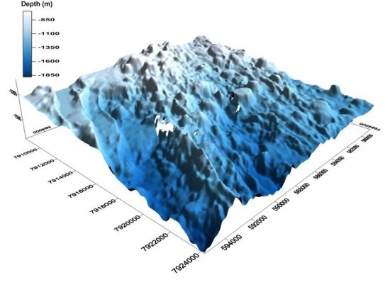
by using a new method, the researchers are able to survey and date the young
lava flows on a portion of the Mid-Atlantic Ridge, and found out episodic
eruptions had taken place.
The
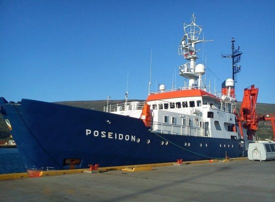
new method, used for the first time on an expedition aboard the German research
vessel POSEIDON, utilises acoustic data of the seafloor obtained by the
autonomous underwater vehicle (AUV) ABYSS and the records from sediment cores collected
in the area. This allows the seafloor to be surveyed without damaging the
terrain.
"In
the past, we have used the AUV predominantly for mapping the seabed, but now we
can also use it to determine the age of young lava fields," said Dr Yeo.
The
researchers could determine the exact position of the mid-ocean ridges in the
region using the new data.
Dr
Yeo also asserted that the amount of lava found over the years (which generated
18 lava flows) would not have been sufficient to maintain the normal crustal
thickness of seven to ten kilometres in the region: "Over the last 8,000
years, we see at least 5,000 years with no volcanic eruptions whatsoever and
what we do see the rest of the time isn't nearly enough. This means there must
be periods of much higher volcanic activity, probably with volumes tens of
times as large as those observed during recent Icelandic eruptions."
Much
of the global mid-ocean ridge system has not been mapped, with very few
detailed studies been done to date. Thus, this new research method has
important implications and opens up new possibilities for future research.
 Mares
Mares 11th April 2016