Team drew inspiration from mathematical principles
A team from the University of Buffalo is looking into how drones can be
programmed to map an oil spill using mathematical principles.
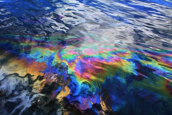
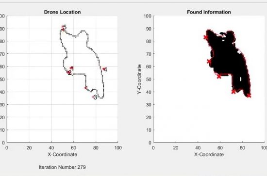
In a computer simulation, five drones working together mapped an oil
spill spanning nearly a kilometre wide in just nine minutes.
“Nature may not proactively use
mathematics, nor does it have foresight. It behaves in ways driven by
feedback, implicit drive for adaptation, and a certain degree of
apparent randomness,” said Souma Chowdhury, PhD, assistant
professor of mechanical and aerospace engineering in the University at
Buffalo’s School of Engineering and Applied Sciences.
“But we can look at what kind of
mathematical principles define that behaviour. Once we have that, we
can use it to solve very complex problems,” he continued.
Chowdhury has pioneered a way to programme drones to quickly map an oil
spill. His efforts were published in a paper which he co-authored with
students Zachary Ball and Philip Odonkor.
The study optimised and
simulated a five-drone swarm that can map a nearly one-kilometre wide
spill in nine minutes.
To achieve that, Chowdhury had to overcome the lack of communication
bandwidth typical of a flying ad hoc network and the short battery life
of off-the-shelf drones.
Following the principles partly inspired by a flock of birds, he
devised a way for the drones to quickly record whether they are over
water, oil or the edge of the spill. In addition, the drones assumed
that the space around the oil they have spotted is also oil, although
that is recorded as less than certain.
This information is shared with
the other drones, as opposed to sharing actual images or video, which
would require too much bandwidth.
As the drones move from point to point over the spill, they avoid going
over space that other drones have already covered. With five drones
making observations every five seconds, the size of the spill can be
determined quickly.
The drones also fly to their base, on a boat, when their batteries get
low. The drones that replace them would have the information from the
other drones, so they avoid previously mapped locations.
“The thematic focus of my lab is developing computational design approaches that take inspiration from nature,” Chowdhury said, adding that there was no need for human interaction during the mission.
His approach uses simple, affordable drones that are accessible to many people. “This
task can be accomplished by off-the-shelf drones that cost under
$1,000. All they need is to have a simple drone-mountable camera system
and use our software,” he said.
The low computer power — each drone can operate with a $35 Raspberry Pi computer — also helps to keep costs low.
Collision avoidance is another challenge. Here, Chowdhury drew
inspiration from nature. A recent study by the University of Queensland
discovered how parrots avoided crashing into one another by observing a
simple rule of always veering to the right. Thus, his lab is exploring
how drones can pre-emptively turn a certain angle to the right upon
sensing another member of the swarm.
In addition to oil spills, swarming drones could be used in forest
fires or other natural disasters.
By changing the cameras on the
drones, they may also be used to locate people trapped after an
earthquake.
More information:
A Swarm-Intelligence Approach to Oil Spill Mapping using Unmanned Aerial Vehicles
Video
 Herbert
 7th March 2017